South Carolina
Add & Edit
Advertise
About
Contact
SC SITE OF THE DAY:
SC Jobs
SC Businesses
SC Cities
SC Entertainment
SC Events
SC Hotels
SC Photos
SC Real Estate
South Carolina – Colonial Maps, Plats, Surveys, and Plans
South Carolina
SC Maps
SC Historic Maps
SC Colonial Maps
SC Colonial Period Maps – 1670-1774
Include Your Link Here
SC Colonial Maps – Statewide
1676 map
1683 map
- South Carolina, North Carolina
1690 map
1696 map
- french, includes land owners names
1710 map
- four counties
1725 map
1741 map
- South Carolina, Georgia
1747 map
- South Carolina, North Carolina, Georgia
1748 map
- North Carolina to Florida
1755 map
- South Carolina to New Jersey
1765 map
- South Carolina, North Carolina, Georgia
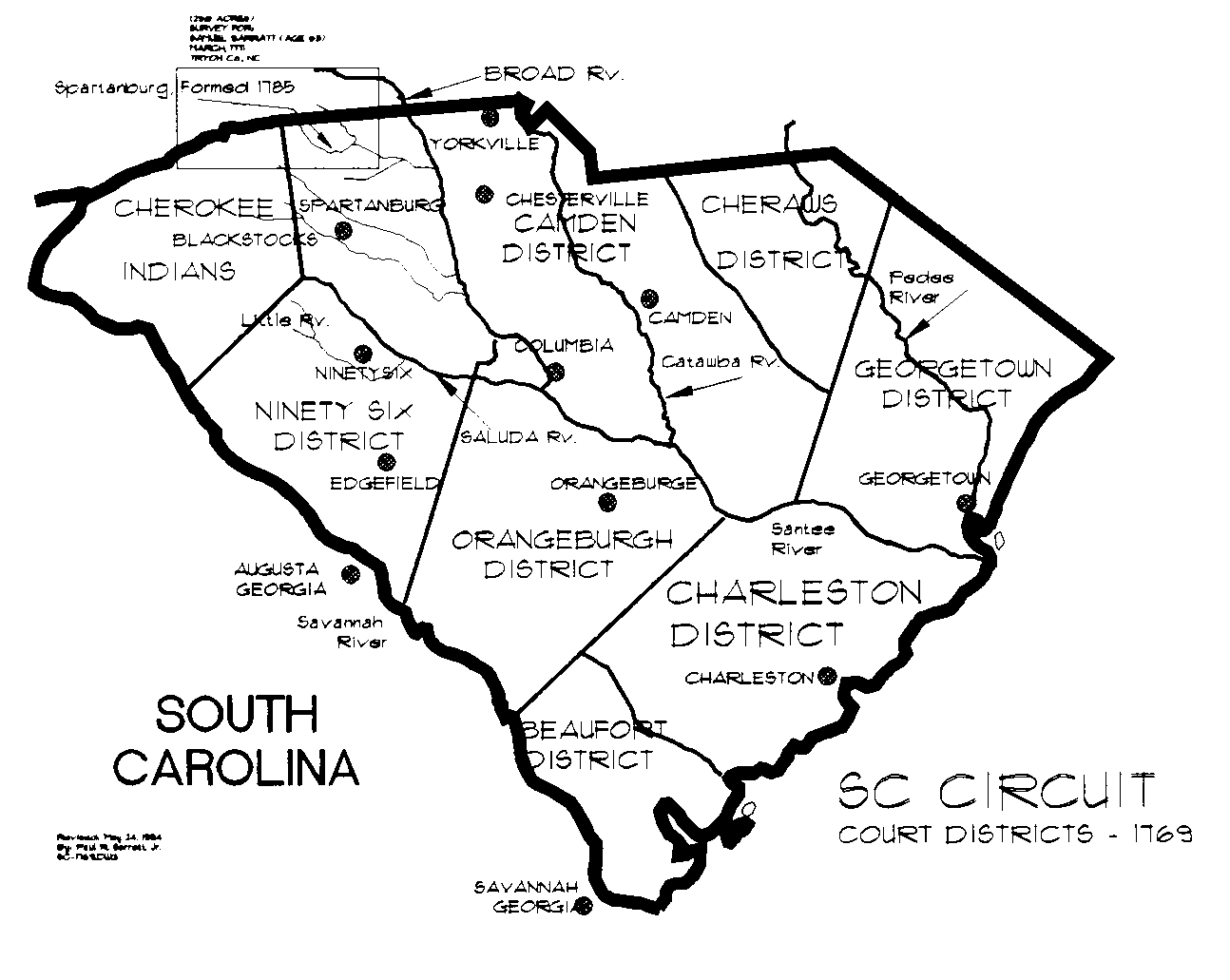
1769 map
- judicial districts
SC Colonial Maps – Counties, Districts
Cherokee Nation
- 1730 - PDF
Marlboro County
- 1737 - aerial photo of southern tip of county
Cherokee Nation
- 1760
SC Colonial Maps – Cities and Towns
Colonial Maps of Boonesborough Township
Boonesborough Township
- 1762 - scroll down
Colonial Maps of Charleston
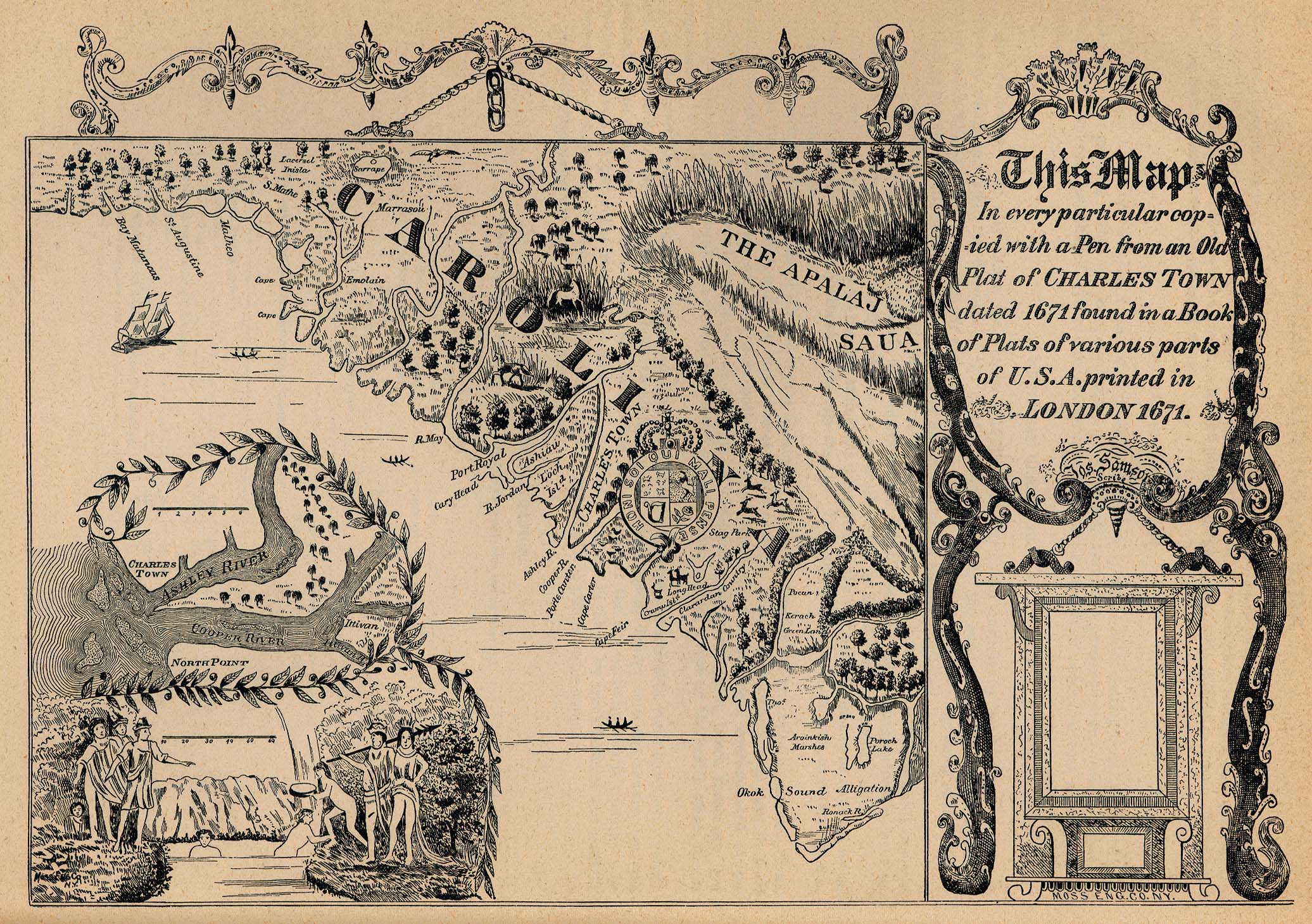
Plat of Charles Town
- 1671
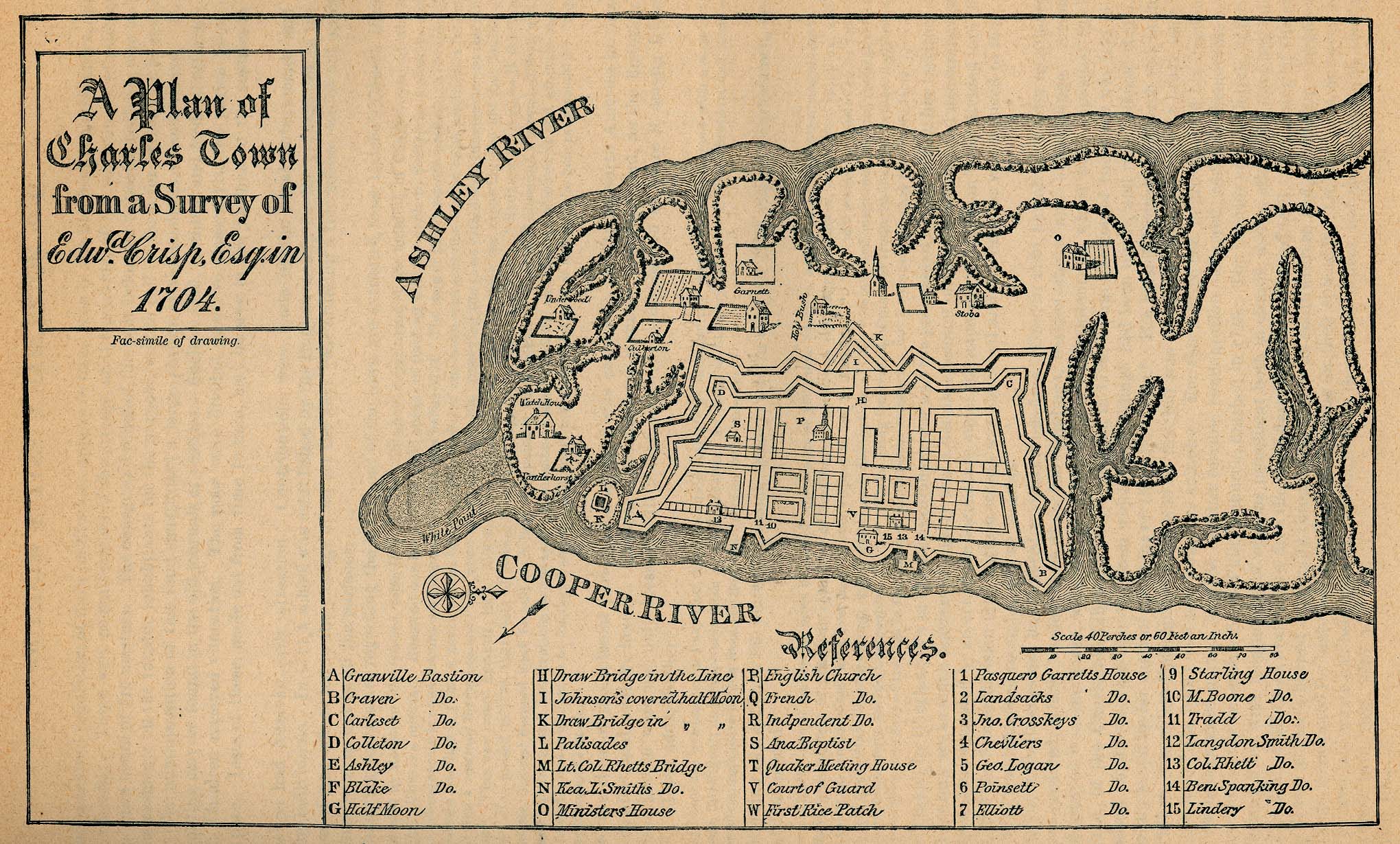
Plan of Charles Town
- 1704
Crisp map of Charles Town
- 1711
Ichnography of Charles Town at high water
- 1739
Port of Charles Town
- 1764
Colonial Maps of Dorchester
Town of Dorchester
- 1742 - scroll down
Colonial Maps of Londonbourogh Township
Londonbourogh Township
- 1762 - also known as Belfast Township - located in current day Greenwood and McCormick counties - scroll down for historic map
Colonial Maps of Port Royal
Port Royal Harbor
- 1732
Search
All SC Categories
SC Bed & Breakfasts
SC Hotels
SC Businesses
SC Jobs
SC Churches
SC Maps
SC Cities
SC News
SC Colleges
SC Organizations
SC Elections
SC Photos
SC Entertainment
SC Real Estate
SC Events
SC Schools
SC Facts & Firsts
SC Taxes
SC Gifts
SC Vacations
SC Government
SC Webcams
SC History
SC Weddings
HOME
ABOUT
ADD INFO
ADVERTISE
CONTACT


